BIM Solutions 1
Space Scanning System
 The Space Scanning System is a BIM tool that can be used to understand a facility space and create renovation plans by directly importing point cloud data that is acquired from a three-dimensional laser scanner to the “S-CAD” CAD software to render an accurate 3D model.
We have already built a vast track record and realized faster and smarter construction from comprehension of the facility space to renovation plans, which have earned high praise from customers.
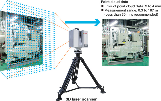
Measurement Principles
The 3D laser scanner is a measurement device that can digitalize surrounding geometry as point cloud data (infinite 3D coordinate points) by quickly performing continuous measurements while scanning an object with a laser. The measurement pitch can be adjusted to match the complexity of the geometry to scan. The standard measurement time for one object is approximately five minutes.
- 1.Existing
equipment
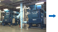
- 2.Create point
cloud data
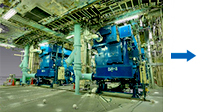
- 3.Render in
3D-CAD

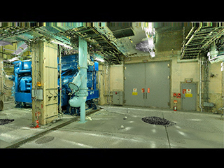
Video Example of Space Scanning System
The heat source machine room has been visualized as video with the point cloud data acquired by a three-dimensional laser scanner. Simulate the space with a walk through. Cloud points are also converted to 3D-CAD.
![]()